
Summer of 2000
(Page 7 of 8 pages)


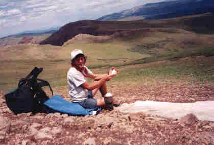
Enjoying the expanse of the high country and trying to soak it all in because I know I'll soon be gone.
From Jarosa Mesa the trail was virtually dry until my campsite on Lost Trail Creek. This was one of the highest sections of the trail and I knew that there would be some snow pack left from winter and this is where I had to stop and melt the snow for drinking water.
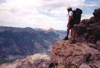
Highest point on the Colorado Trail!
At 13,240 feet, this is the highest point on the CT which is just east of Coney Summit.
From Lost Trail Creek on to the Elk Creek CanyonJuly 24, 2000 (Hiked 24.6 miles)
Day 26
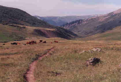
Still above the treeline in the Pole Creek valley, I pass by some open-range cattle who were enjoying a bit of grazing.
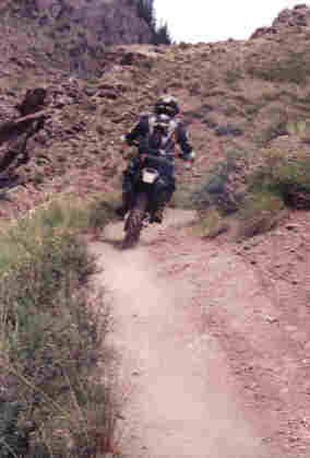 | Believe it or not, there are some parts of the Colorado Trail in the National Forests which actually allow motorcycles to use the same path. Although a bit noisy the lead cyclist always stopped and let me know how many more bikes were behind him which I appreciated. | .
The Rio Grande River
| Here is the famous Rio Grande river which was flowing sort of low today so fording across wasn't too bad. | 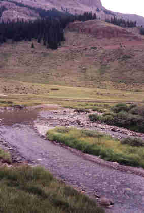 |
You never know what's in the water so you'd better treat your water in this country!
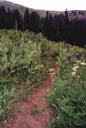 | The lush vegetation on the trail in the San Juan Mountains reminded me more of a tropical environment than the high altitude mountains of the west. | .
From my journal (July 24th;Day-26)..."It's been another amazing day on the trail and it looks like I might have pulled off another 20-plus mile day as I sit here resting at 5:00 p.m. on the edge of Elk Creek... the clearest and bluest water that I've ever seen! This morning I came down the forever long Pole Creek valley after climbing out and over the unnamed pass from Lost Trail Creek. Up on the saddle I saw another herd of maybe 50 elk which was so inspiring in the early morning. Coming down the Pole Creek valley was painful since some new blisters have suddenly formed on my heels. I finally stop to cook a hot meal just before noon and to wash my hair, all which helped a lot.
"Not far off was the Rio Grande river which the guidebook says is "deep and precarious" but today I crossed it with just a tiny splash that was all dry in 10 minutes! It was then on up the Bear Creek valley where I had to follow a jeep trail for four miles and a rare rainfall also came and went and I sort of got tired putting on then taking off my rain parka. Up to the Continental Divide was tough but easily offset by the stunning beauty of the colorful flowere and lush growth that seemed more typical of a tropical environment.
"On top I take some amazing photos while realizing that this would be my last crossover of the Divide. As a thunderhead is nearby I got busy descending into the head of Elk Creek via a maze of about 30 switchbacks on an extremely steep mountainside. It was very windy and overcast so I wanted to get down fast! After entering the headwaters of Elk Creek I was soon in an amazing canyon with vertical walls shooting straight up to God! Absolutely incredible! I stopped to camp when I was far back below the treeline and end up eating my last dinner meal, so I must make it to Silverton tomorrow! Good night."
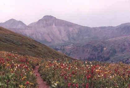
The abundance of colorful flowers in the San Juan Mountains make this a heavenly section of trail to hike. This section of the trail was on my ascent out of Bear Creek.
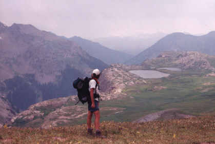
Atop the Continental Divide for the last time, I tried to soak in as much as I could before heading into the low country of Elk Creek to camp. One day I'm gonna come back here and visit those two lakes!
| Here the trail drops off suddenly into the Elk Creek canyon. | 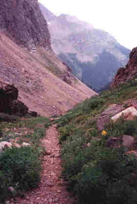 |
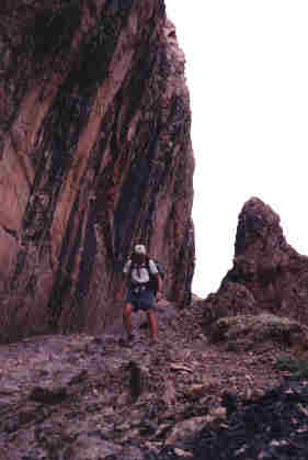 | The Elk Creek canyon was the most spectacular canyon on the trail with sheer cliff walls that seemed to touch the heavens! | .
On the last page I'm chased by a vicious thunderstorm near Molass Pass, meet a volunteer trail crew for the Colorado Trail, and complete the final leg of my hike to Durango!
 |
 |
 |