DOWN THE YUKON-Page 2

From my journal (May 20th;Day-1)..."At Ten Mile Point I begin to see the ice that the Carcross man had spoken about. It was mostly a blue, clear color showing the presence of a very thin crust between solid and liquid. It had mostly broken up and was in big shifting pieces. At the rear edge I begin to negotiate my way for an hour to cross this quarter-mile stretch of broken ice. It was difficult in the rain but I felt safe as long as I dared not go further out than the shallow edge, leading my boat (the Voyager) safely in, around and over the jagged ice. Finally I felt a lot of relief to reach the other side, having stopped 5 times to dump frozen water out of my boots, ringing out my socks and warming my frigid toes!"
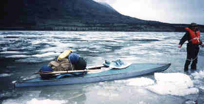 This kayak is made of some really tough material because this was just the beginning of the ice, rocks, and debri that it was pulled, pushed, or paddled over! | .
From my journal (May 20th;Day-1)..."At about 3:00p.m. I've come 6 miles across the menacing lake to a point where Nares Lake and the Windy Arm meet to form Taggish Lake. Following close to the right shore I cross the point and immediately understand the idea behind naming this new lake the Windy Arm on the topographic map.
"The winds and waves drove me back just below the point where I set up my first campsite."
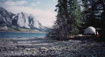 I couldn't imagine having a nicer piece of real estate to claim as my very first campsite! Bear tracks were everywhere on the beach but I just kept a very clean campsite and enjoyed my piece of heaven that I had dreamed about for so many years. Yes,I was really here! |
From my journal (May 21st;Day-2)..."Ice on the water laid heavily upon my mind as I paddled around each new bend. Would it be broken apart, or like Nares Lake would the remaining frozen reminder of winter still be blocking my only route?
"This evening I'm happy and very grateful that all the ice seems to be gone. I couldn't have chosen a better summer to be on the Yukon, but I can't help but wonder about my reaction if I'd been stopped for several days waiting for the ice to move on? I'm just glad that it didn't happen and I'm now well on my way to Dawson City... landmark of the Klondike goldrush and just 500 more miles away!"
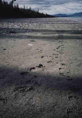
 These wolf tracks were as big as an opened human hand. | .
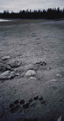
These two sets of bear tracks walking together were on the beach near my campsite on Taggish Lake. After paddling in a lake with mostly no current I was very tired and wished for a moment that I had packed my rifle!
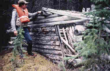 From the water I spotted a lot of old decaying cabins, which were remnants of a bygone goldrush era as thousands of fortune seekers rushed up the Yukon to Dawson. I stopped and inspected every cabin that I saw and couldn't help but to think about who had been here. What kind of people were they? Where did they come from? What were their own dreams? I will never forget these old rotten cabins and the mysteries that they can not reveal as they slowly melt away back into the earth. I always left reluctantly and desperately wanting to know more. |
From my journal (May 23rd;Day-4)..."Today I paddled 17 miles and was finally off of the Yukon headwater lakes and onto the actual river that I'd come so far to navigate. The water was amazingly clear and even deep blue in places. I could even see the bottom at perhaps 15 feet...just like the water on Tagish Lake.
"Like entering each new lake, the mouth of the Yukon had its own unique personality unlike any other section of the river. The terrain was full with spruce and aspen trees although somewhat low and swampy with a lot of side lakes and pools of water, a much more "open" countryside.
"It was also unique how I began to feel the current start pulling my craft and after so many days of fighting the headwinds of the wide lakes, this was a relief indeed! Just as the last lake funneled itself into a river, I zig-zagged from bank to bank in celebration of the event. Here my pace was put into a higher gear and my strokes were much lighter for the amount of speed I recieved in return.
"The river bent to the right and followed the Alaska Highway for a short distance which was a weird feeling to see the motorized society zooming by at 60 mph.
From headwaters to a river!
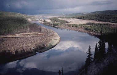
On a very wind-still evening I couldn't resist climbing a cliff for this aerial view of the river just as I was leaving the headwater lakes behind.
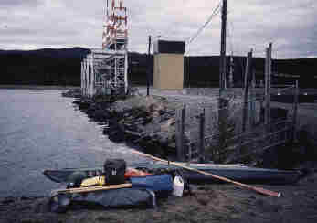
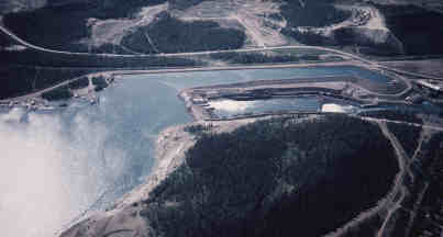 From the air on my return trip here is the only man-made obstacle on the Yukon, a hydro-electric dam at Whitehorse. I spent the better part of my sixth morning portaging my kayak and all of my gear around this dam. | .
On my fifth day I have made it back to Whitehorse, or at least to the dam. This was my campsite just across from the dam.
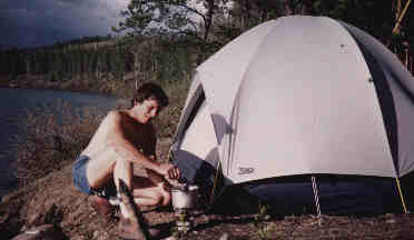
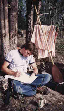 Like all of my trips I spent a lot of time keeping a thoroughly documented journal and today was no exception to my commitment. |
At the top of the dam preparing to portage.