|
|
|
|
|
|
|
Appalachian Trail... photos and journal
Spring of 2002... In the upper south...
(Page 1 of 7 pages)
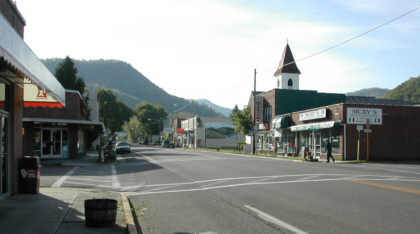 | Looking north toward Whitetop Mountain from the AT on Main Street in Damascus. This is a really nice trail town and just a plain nice small American town... not too big and not too small and a place where even a wilderness clad fellow could call home. | .
From my journal(May 6th) Day-20..."Its never been so nice to finally reach a town as it was when I walked into Damascus yesterday evening, so tired and with a food empty backpack. In four days and three nights that certainly was a tough pull from Erwin. I stayed over at the Place, a hostel owned by the Methodist church. Sleep didnt come easy dure to the hard wooden bunks, but it was so nice to be in the company of so many other hikers with aspiring dreams and the hot shower was nice too!
As usual I was up early and had a big breakfast of biscuits & gravy plus a three egg omelet at Cowboys. I then picked up my float box from the post office and spent some time with email at the library. Thanks to the generous donations of Bill Gates hikers now have five new computers to work with.
Of course I managed to eat continiously all day including a wonderful banana split at the Dairy King, then took a nap and was back on the trail at 4:00 p.m. Leaving town I took the lush and beautiful Virginia Creeper Trail and have made a nice stealth campsite about a half mile shy of the shelter. Tomorrow it will be up to White Top Mountain, Grayson Highlands, and beyond! "
| The Damascus post office as you can imagaine gets quite a bit of hiker business this time of year! | 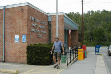 |
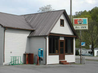 | Dot's Inn has been around forever and a great place to get a good meal and a beer. | .
| Did the red in this flower catch your eye like it caught mine! | 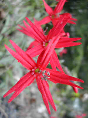 |
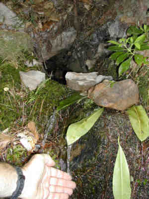 | A mountain laurel leaf and a rock can make an effective spout for directing water from a sping into your water bottle. | .
From my journal(May 7th) Day-21..."Just as I was drifting off to sleep some deer began blowing and hissing nearby, as I must have set up on their trail. I slept so good last night on this soft spot and such quiet forest. At 7:00 a.m. Im walking on a still dry trail but with a gray overcast sky. Up Whitetop Mountain I went into the clouds and heavy winds and fell down on Buzzard Rock while trying to get some pictures.
At Rhododendron Gap I took the Pine Ridge trail, the Cliffside trail, and the Lewis Fork trail to Old Orchard Shelter. Just before Dickey Gap I stopped near a stream to cook a meal when the rain began. I snuggled up to a huge fallen tree and threw my ground cloth overhead until I was done. The evening walk was nice although a light rain came and went. Just at dark I go down to Trimpi Shelter for water then hike 1/10 mile north to camp on a ridge where I can hear the faint yet constant noise of what must be Interstate 81. "
| It was a quite chilly day and very windy when I made it to the top of Whitetop Mountain and here at Buzzard Rock. What you don't see is only seconds after this photo the wind blew me down on the rock fairly hard but nothing a couple of band-aid's couldn't handle. | 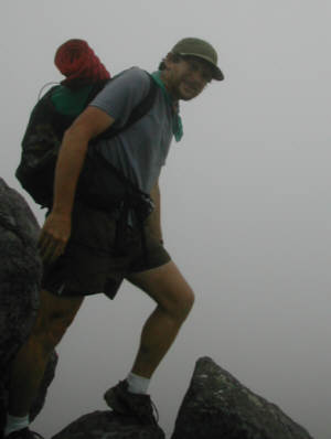 |
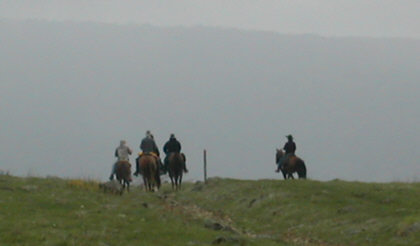 | There is also a nice horse trail through the Grayson Highlands as I photographed from Elk Garden. | .
From my journal(May 8th) Day-22..."Another amazing day on the trail as I was off my ridge and hiking early. The woods were so alive with the spirited sounds of birds announcing another new day. The trail was relatively nice walking with both gentle ups and downs through a mostly wooded forest and the occasional farmland field, which offered a nice diversified walk. At the Mt. Rogers National Recreation Headquarters there is the Partnership Shelter complete with a warm water shower so I utilize it wisely!
I also enjoyed a nice conversation there with two hikers, Scarf and Rocky Top. I drink a coke then hit the trail again for I-81 where I resupply for the 2 ½ days to Pearisburg. There were four other young thru-hikers there whom I also enjoyed talking with.
It was a very hot and humid walk but I made it to Tilson Gap just in time for a great orange sunset. Highway 610 is only a mile north from here and that marks the one-fourth point of the AT. So Im excited about making it that far here tonight!!! "
| Where the trail crosses under Interstate 81 at Troutdale. | 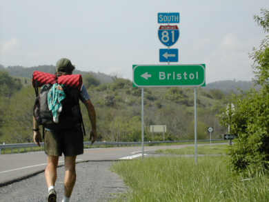 |
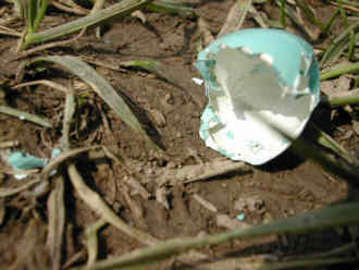 | A recently hatched egg on the trail. It's one thing to discover an animal whose trail has ended, but here a new trail has begun! | .
| Not far past I-81 at Troutdale I looked back to this beautiful pastel of yellow. | 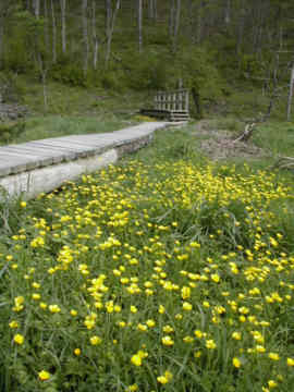 |
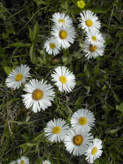 | More daiseys but still no Daisy Jane. | .
BACK |
AT HOME |
NEXT |
|
|
|
|
|
|
|