UP THE INSIDE PASSAGE-Page 7

Welcome to Skagway!
August 4th; Day-69
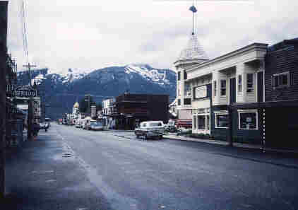
Here is a view looking north down the main street in Skagway and as far north as the Alaska Ferry can go. It was only a short cruise on "Columbia",the largest of all the ferries. Skagway has a very rich history as the grand portal for the Klondike goldrush of 1898. If you'd quickly like to learn more about Skagway then just click the following link to open a new browser to their informative homepage: SKAGWAY!
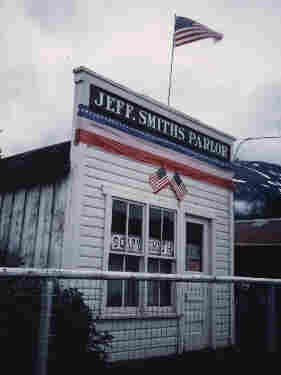 This was Soapy Smith's original bar which is being restored. He was a con man and one of the last true outlaws who eventually died in a shootout with a concerned citizen who had had enough of his lawlessness. |
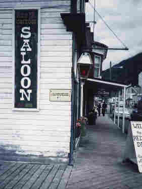
The famous Red Onion Saloon is on the corner of main street just as you step off the boardwalk into town.

The Chilkoot Trail...on the "trail of '98"
August 5th; Day-70
One of my foremost goals of the summer was to hike the 33-mile Chilkoot Trail from Skagway to Lake Bennett, which is the headwater lake of the Yukon river which I had paddled two years before. By hiking the trail I would not only be following the foot steps of the Klondike goldrushers, but I would also be making my final connection of a completed journey.
A bit of history...
The Chilkoot Trail is a 33 mile long trail accessible only on foot. The Chilkoot Pass, is crossed 17 miles into the trip at the U.S-Canada border and reaches a height of 3,550 ft. (1080 m). It was one of three main routes taken by the Klondike Gold Rush adventurers or stampeders as they were called, to the gold mines of the Yukon. While it was the shortest section of the trip (600 miles in all) into the Yukon territory, it was the hardest. The stampeders had to carry everything they needed from the tidewater area of Skagway and Dyea, up over steep slopes to the summit and down to the lakes. The stampeders could not carry all the supplies they needed for their expeditions in one trip, and thus moved their supplies from cache to cache, making the trip along the Chilkoot Trail a number of times before they were able to buy or build boats for the the river trip to Dawson City, and the surrounding Klondike mining district. The stampeders were required by Canadian ruling that each person crossing the border have a year's supply of food. This provision requirement, combined with average personal items, average weight was a ton. After a few attempts many of them gave up, sold, or abandoned their belongings and supplies along the trail. An estimated 20,000 to 30,000 people passed along the Chilkoot Trail into Yukon territory. Today, in an effort to preserve the area, access to the whole trail is monitored by the National Park Service, and Parks Canada Wardens ( Canadian officials are imposing a 50 hiker-a-day limit at the Pass).
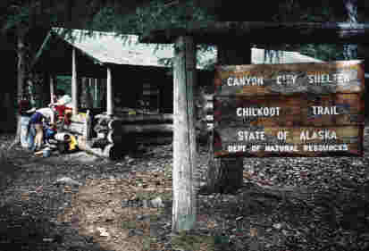 This is one of the campsites along the trail, site of the deserted Canyon City. |
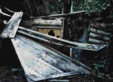
The Chilkoot Trail is referred to by many as an outdoor museum. Even old decaying cabins like the one in the photo are highly protected by the National Park Service and cannot be disturbed in any way.
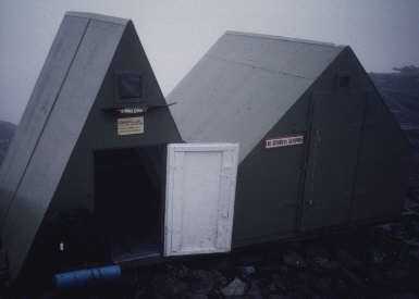 At the Pass and on the border with Canada, these were two emergency shelters where I took a half hour hot lunch refuge then continued on to lower ground. |
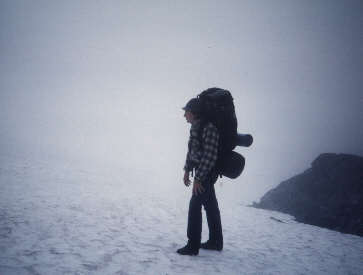
From the Pass I had to hike in the snow for quite a ways which was really wonderful considering that it was only early August!
 On the Canadian side of the trail were several graveyards marked with wooden head markers dated 1898 and the final resting place for a lot of folks on the adventure of their lives! |

And finally here is Bennett Lake and the northern terminus of the Chilkoot Trail. That is the episcopal church which is the only remaining structure left standing from a once booming goldrush town, now completely "melted" back into the grand wilderness except for this old church.
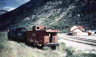 This is the old White Pass train station at Bennett Lake which traveled between Whitehorse and Skagway for many years. |
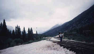
And finally it was the end of the trail, the end of my summer and for the first time I am hiking south heading back home. I remember singing "Homeward Bound" as I followed the tracks for several miles out of the wilderness to the Skagway highway where I caught a ride back to the ferry, thus concluding one of the most memorable summers of my life!