Pacific Crest Trail... photos and journal
Summer of 2001...Central California...
(Page 3 of 7 pages)

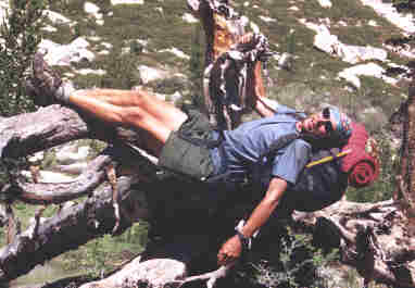
Resting on the roots of a fallen tree while heading toward Muir Pass.
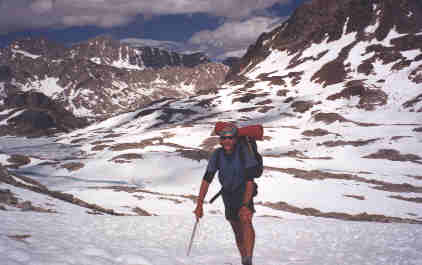
Into the snowy wonderland of Muir Pass...
Snowy Muir Pass was probably the most difficult to navigate across the Sierra's this year and I didn't meet a single hiker that didn't wander away from the hidden trail in this area.
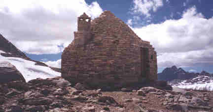
A strong stone Muir Hut built in 1932 welcomed me at the peak of Muir Pass. This photo doesn't do the intricate detail of the stonework justice, being built similar to an Eskimo igloo complete with a huge open hearth fireplace and beautiful wood/glass door.
From my journal (June 5, Day-41)..."A pleasant walk it was through Deer Meadows along the path of the Middle Fork Kings River during the early morning hours. Small herds of deer abounded and they would just freeze stiff as I passed by them. In one section I began to see fresh wet bear tracks on the rocks at stream crossings so I retrieved my ice ax to ping on rocks to make some noise. This morning like most now, I have really come to enjoy my early breakfast breaks. Since reaching the Sierra's mornings are now quite chilly so I usually just eat a bagel while packing my backpack, then when the first warm rays of the sun strike over the high ridgeline, then I will find a nice sunny spot to stop, fix my cereal, air my feet, and review the guidebook and maps for the days hike. It is also so special to me in the mornings to have that sense of aloneness as I walk through the forest and cherish my early break. Things along the trail are alive and fresh with the first light of day and this recharges my soul and spirit like nothing else can. It has become an essential ingredient to such long distance hikes.
Grom 8,020 feet at Middle Fork of Kings River I'm now hiking up one of the most beautiful valleys yet which will eventually land me at 11,955 foot Muir Pass. I stop a lot along the way just to saturate myself with the immense sense of space in an attempt to somehow grasp hold of all the ecological perfection before me... cascading waterfalls rushing down 1,000 foot mountainsides, snow topped summits, the rushing streams, and waterfalls along the valley bottoms... all so much to grasp, but I try.
Muir Pass ends up being so much more than I had expected. Most passes have been your typical "up and over" but Muir Pass went on and on for miles of rough to navigate and trod over mostly endless snowpack. The snow had become quite slushy with the afternoon sun and my legs would regularly and suddenly sink up to my thigh thus causing a lot of ice burns and bloody abrasions when there was a hidden boulder of granite below. This did become quite frustrating at times since it was painful and ever more so made my forward progress slow. In a few places before reaching the stone Muir Hut I had a hard time navigating my course through the snow and weaving through the many frozen lakes, once getting way off course when I spotted a tiny piece of the PCT from far above that had thawed. Rather than retrace my path of the last half mile I was glad to have my ice ax which made it possible to cross a 45 degree bank of snow pack about 15 yards across to a point where I could easily cross the stream and get back on course. Although progress was slow I was able to chop and stomp out steps in the snowpack then I would plant the pointe side of my ice ax into the bank as an anchor to grasp upon as I would take the next step. After reaching the stone hut at the height of the pass my tiny scaled guidebook maps finally made sense and it was such a relief to positively identify the huge Wanda Lake. There were still several miles of frustrating frozen snow, ice, cold water, and hidden boulders of granite to cross, but I always tried to retain an awareness of the immense beauty of my surroundings while plowing my course. By dark I was finally back into the cover and security of the trees and made my camp on a hidden ledge just past the rangers log cabin in McClure Meadow. "
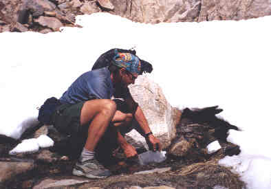
Getting some water from a snow melt. I was amazed by so many hiker's that hauled heavy water on their backs through the Sierra's because it was everywhere.
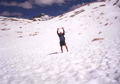
The trail was hidden deep in the snow for many miles across Muir Pass and you just had to rely upon your map, compass, and instincts.
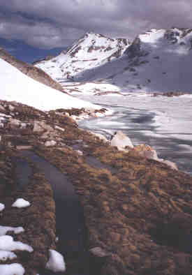 | While in the deserts of southern California I often joked about how nice that it'd be to have trails paved with water... well, I got my wish in the Sierra's where the snowmelt was in full force along these broken pieces of the trail gradually revealing themselves. This shot of the trail was taken beside a still frozen Wanda Lake on the north side of Muir Pass. | .
From my journal (June 6, Day-42)..."At 7:00 am I have arrived at the very wide and deep Evolution Creek... and there is no bridge. With dozens of stream crossings behind me I have now developed a confident routine of evaluating the stream and preparing myself for the crossing. This was a big rushing stream so I checked it out a hundred yards in both directions first finding the best passage spot about five yards upstream, so I found two strong limbs for balance poles and since it was still early morning I put plastic bags on my feet then put my socks and shoes back on. I made the crossing just fine then found a sunny spot on the granite outcropping down trail a short way to dry out, escape the mosquittos and to eat some breakfast. Most of the morning was spent hiking down a magnificent valley and crossing the south fork of the San Joaquin river by foot bridges at two points. I also met a fine gentleman here named Bruce "Stick" who was from Idaho and had already hiked the PCT in '99.
Mike and I had lunch together before begining our ascent of Selden Pass at 10,900 feet, it was another most beautiful passage where most of the snow was gone, but just enough left to soak my socks and make me mad! It was another most beutiful passage where most of the snow was gone, but just enough left to soak my socks and make me mad! The final ford of the day was at a very powerful Bear Creek, but I made it across OK as I was now acclamated to these stream crossings. I finally make camp high above at 9,980 feet on Bear Ridge knowing that tomorrow I will have completed my longest stretch of trail at 167 miles and six and a half days from Kennedy Meadows when I would get to VVR- Vermillion Valley Resort. "
Retreat at VVR (Vermillion Valley Resort)
It had been a very long haul coming all the way from Kennedy Meadows so we were anxious to arrive at Vermillion Valley Resort which satisfied our every need. The staff really treated us well starting with a personal escort off the ferry with introductions to other staff, then giving us a free beverage of our choice and the first nights stay in the canvas bunk tent was free. Some hiker's complain about places like this being a money rip-off but it's not cheap to generate your own diesel electricity where there are no powerlines and this little chunk of real estate on Edison Lake cost the owners several hundreds of thousands of dollars and they certainly are entitled to an income of some sort. Owner Peggy Wiggs certainly has a good understanding of the hiking scene and went out of her way to meet our needs. I had expected to receive a replacement pair of hiking shoes here that didn't arrive so she made a special stop by the post office to see if they had come and when they didn't she forwarded them on after I left. This was a great place with caring people, not to mention the best 55 gallon barrel hiker's box on the trail.
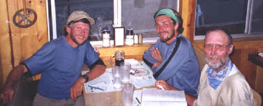
(L to R) Me, Mike, and Bruce just after eating a huge dinner at the resort restaurant.
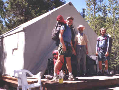
Here we are just before leaving VVR on the porch of the canvas bunk tent where we stayed for a night. The mice here are fearless so you'd better secure your gear and food well, even when it's just a few feet away... so don't say that I didn't warn you!
From my journal (June 7, Day-43)..."As usual I was hiking early to a very chilly morning at almost 10,000 feet, but I was quickly shedding clothes as I sped down the 53 switchbacks off Bear Ridge until I was at 7,850 feet on the valley floor and in a t-shirt and shorts. At Mono Creek I crossed the foot bridge then took the side trail for about a mile down Mono Creek to the mouth of man-made Edison Lake where I had to wait about an hour and a half for the ferry to VVR. Mosquittos were bad so I had to set up my tarp/tent to keep them at bay. At 9:45 am the ferry arrived and it was about 20 to 25 minutes across the smooth blue water to the resort. Golks here sure were excessively hiker friendly and the resorts cook "Frank" walked me up to the store where I was given a free beverage of my choice and was granted one free nights stay in one of the canvas tarp cabins. The hikers box here was really good as Mike and I plowed through every item in the 55 gallon barrel. Terissa then took all of our dirty laundry to wash and dry as we took a most refreshing warm shower. Lunch was good and I had Halibut steak for dinner as the movie "Gladiator" payed in the background. Bruce also joined us this afternoon as we ate, drank, and exchanged tales from the trail for several hours and until it was dark. "
| Mike hands Bruce a pack from one of the boats that ferried us across Edison Lake back to the trailhead. | 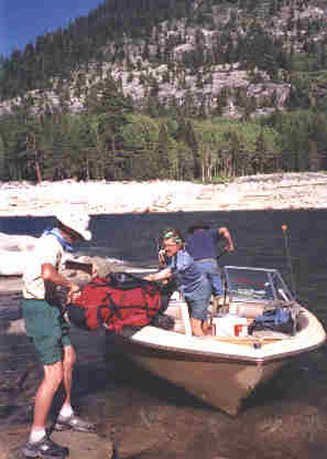 |
Join me on the next page as I hike to and through Tualomne Meadows.
BACK |
PCT HOME |
NEXT |