Pacific Crest Trail... photos and journal
Summer of 2001...Central California...
(Page 2 of 7 pages)

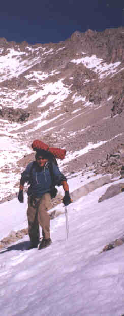 | Climbing up the south side of Forester Pass. | .
| Me atop Forester Pass, highest point on the entire PCT at 13,180 feet. | 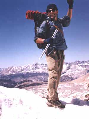 |
It was a very long descent from Forester Pass where the trail was completely snowbound and I ended up doing more sliding than walking.
From my journal (June 3, Day-39)..."Up early again to near freezing temperatures and my shoes are semi frozen stiff so it was hard loosening them up then getting my toes to working in them. I knew right off that I should have crossed Tyndall Creek yesterday since it was the last ford before Forester Pass, but the light of day just ran out on me and now I was facing a very cold early morning ford. Since I definitely wasn't born with balance gene I had found myself two good tree limbs to help steady myself across the icy cold water... with my shoes on this time. I made it across fine this time but just as I got to the other side I suddenly realized that I'd made a very big mistake in crossing this frozen stream at 7:00 am. long before the sun had even begun to shine on this deep mountain valley floor.
I immediately went down while slinging off my backpack and getting off my shoes and socks, then wrapping up my now numbing and hurting toes and feet into my thermal vest. This didn't seem to be helping much and I knew that I had to build a fire quickly as my numbing feet became worse, shomehow I had to get into the trees about 25 yards away so I unwrapped my feet then put them into my untied wet shoes and high-tailed it to a spot where I managed to get a flame going then I knew I was going to survive yet another close encounter with the perils of the PCT!
By the time I'd survived my ordeal and eaten some cereal the early rays of the sun had begun to penetrate the valley bottom. From here I hiked up toward Forester Pass which at 13,180 feet it is the highest point along the PCT. After my feet were warm and snug again it was a most pleasant hike as I passed through a few stubborn growths of trees then onto the tundra. I found myself both stunned and lost within the immense beauty of it all while knowing how fortunate I was to be here. And although I could see no one I had passed Mike's shoe prints in the frozen raised ice crystals on the early morning trail, so I knew that he wasn't too far ahead although I didn't see him all day. At one point I had put my ball cap on over my ski mask to help block the sun from my eyes then apparently during a gust of wind it was blown off my head into the vast open space without me feeling anything. I searched frantically to find the hat which had served me well for 700 miles through the desert, but with no such luck of finding it again.
As I approached the base of Forester Pass I had to cross numerous snowpacks then with my ice ax in hand I was climbing a very steep bank of ice several hundred feet up to where I finally found a few sections of the switchback trail, but I still had to cross some very steep sheets of frozen hard snow. I just took my time taking only two steps, then replanting my ice ax like an anchor before proceeding. My ice climbing and snow camping training from the North Cascade's during the mid '80's was paying back some huge dividends! It was great to reach the top where I felt like I was on top of the world and I had it all to myself. According to my guidebook it was now all downhill to Canada with a net elevation loss of 9,000 feet! OK... Whatever!
On the other side of the pass there was absolutely no trail, but only a solid sheet of snow for several hundred feet down to a frozen lake. There was just no way to walk on such a steep bank of snow so I planted my butt down and thus the sliding ride of my life began. I was able to regulate my speed by planting the hook of my ice ax into the snow and the accumulating snow between my legs would slow me down.
By late afternoon I had made it through the gorgeous valley and Vidette Meadow with its rushing streams, waterfalls, and snow capped mountaintops like the paradise on earth that it was. It was also a highlight of the day to pass by the Kearsarge Trail junction which led 24 miles to the town of Independence and where I'd originally planned to resupply. Now that my pack was much lighter it was a great feeling to continue on the trail knowing that I had plenty enough food for another four days. I also managed to get over Glen Pass at 11,978 feet by late afternoon and found myself skirting across another huge mountainside of solid snow for several hundred feet down.. It was very scary as I said several prayers for an avalanche not to occur. By almost dark I was to the crystal clear Rae Lakes area where I made camp on a small snug ledge near the vacant rangers station. What a day!"
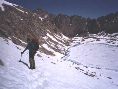
Looking back toward Forester Pass and coming into the headwaters of South Fork Kings River was some of the most beautiful country I've ever seen.
 | On my way to Pinchot Pass. | .
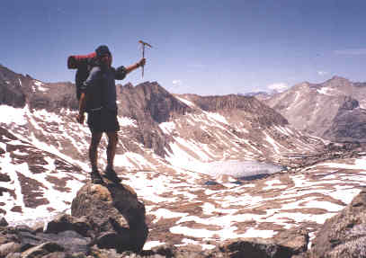
Proudly atop Pinchot Pass.
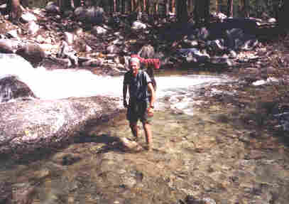
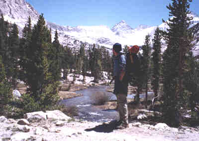
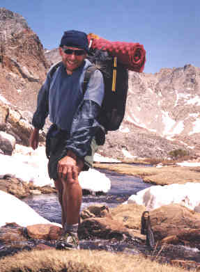
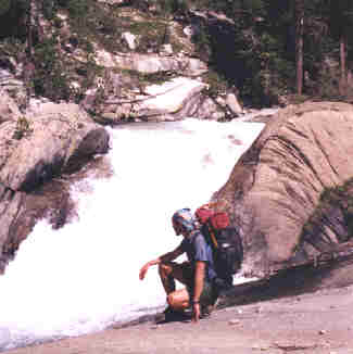
This was one of the lighter fords across South Fork Kings river.
From my journal (June 4, Day-40)..."Another morning that I had to loosen up the ice in my shoes, but I was still up and gone at first light hiking down the valley. This entire section of the trail through the Sierra's is just a series of straight ups and downs from one valley to the next pass and so forth... quite a change from some of the desert crossings. There was a lot of frtost on the logs crossing some of the streams so I had to be careful not to slip into the icy water so early in the morning. Like I didn't already know how that felt! At Woods Creek I had to cross the huge creek on a swinging bridge then it was a long 7 miles up to Pinchot Pass at 12,130 feet. Near the pass it was a pleasant surprise to run into Mike who was cooking a hot meal on his modified Sierra wood stove. We exchanged stories and tales which lifted both our spirits to go ahead and take on the pass. Then it was back down to the valley bottom and up to Mather Pass at 12,100 feet. After crossing by a couple of semi frozen lakes we made camp on a couple of flat spots along the very steep canyon descent toward Deer Meadows. "
| Mike Pook cooking a late afternoon meal before pushing on. | 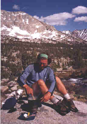 |
 | Just one of the many magnificent waterfalls as I got closer to Muir Pass. | .
Join me on the next page as I cross a very snowbound Muir Pass then re-supply at Vermillion Valley Resort on Lake Edison.
BACK |
PCT HOME |
NEXT |